
Cloud that could catch colour
Find where broken cloud might light up towards the sun, overhead and behind the camera. The optional fire-sky overlay picks out promising areas.
UK landscape photography
Pick a viewpoint. See when the sun clears the ridge, which clouds could catch colour, and whether fog might gather in the valley below.
The sun path
Trace the sunrise or sunset bearing from your camera across the UK. Check low, middle and high cloud along the whole path, including distant cloud that could hide the disc.
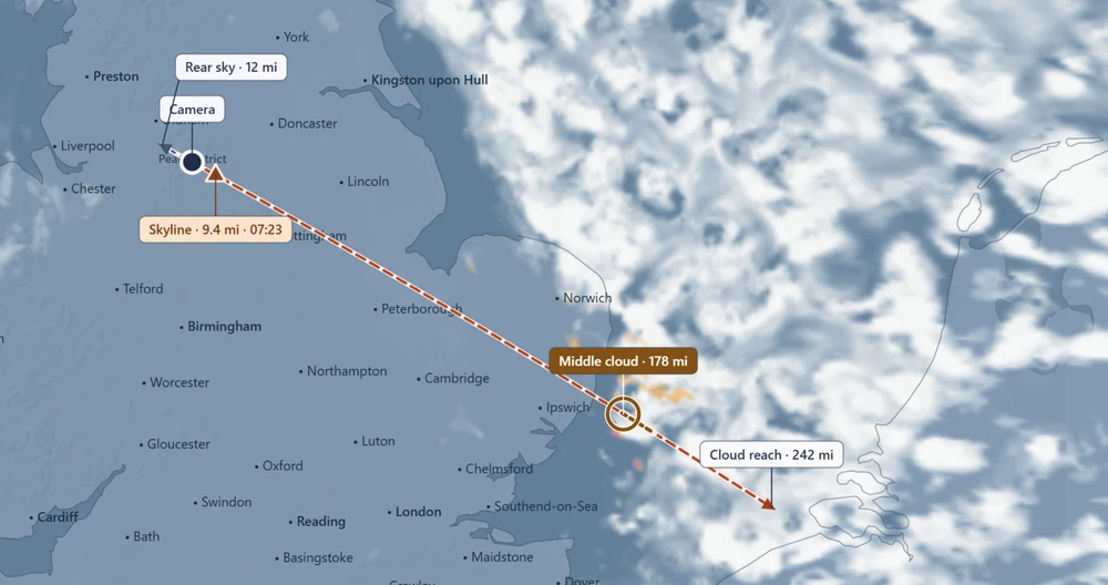
On the map
Find where broken cloud might light up towards the sun, overhead and behind the camera. The optional fire-sky overlay picks out promising areas.
Switch to fog alone to compare the pin with lower ground nearby. Look for a valley fog signal and see which evidence is available for an inversion.
Play through the published Met Office forecast steps on a fixed map. Switch between cloud, temperature, humidity, wind and pressure where supplied.
Timing the shot
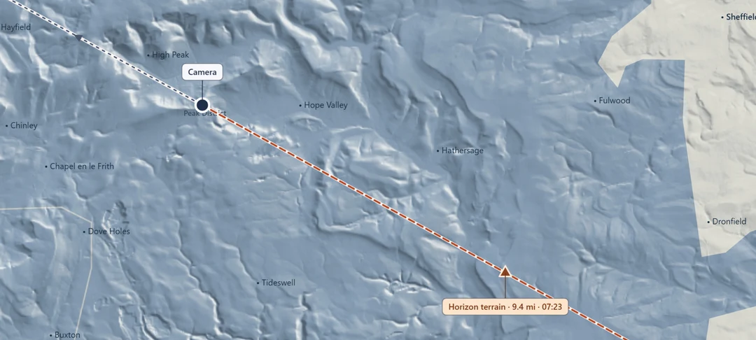
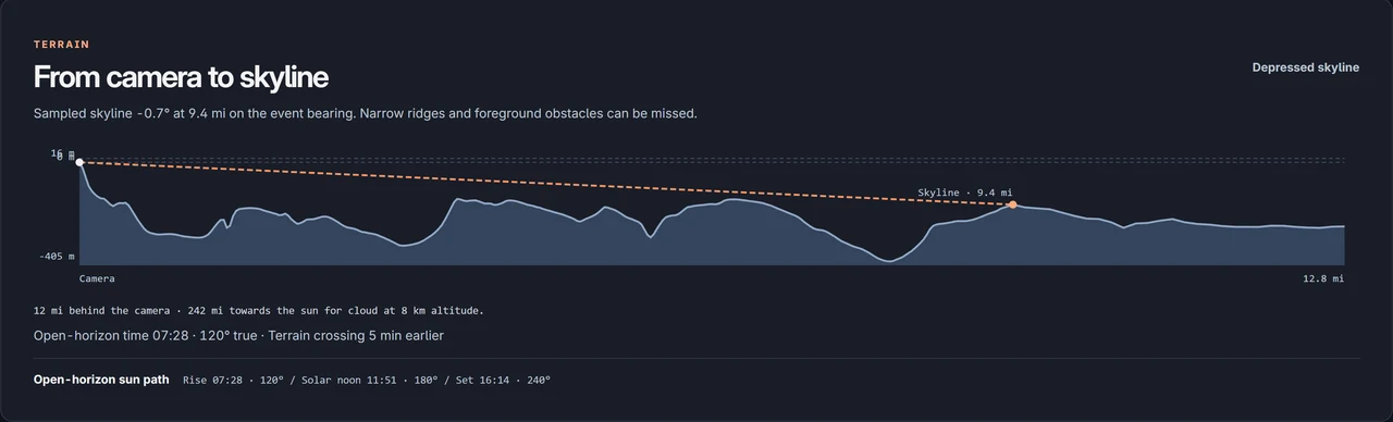
Drop a pin on a summit or search for a viewpoint. OS contours, slope shading and a terrain profile show what lies between you and the open horizon. Plan around the estimated skyline crossing and the golden and blue hour windows.
Membership by invitation
Save a favourite spot and check the next shoot from your phone or laptop.